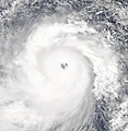
File:Haiyan 2013-11-07 0420Z.jpg

預覽大小:450 × 600 像素。 其他解析度:180 × 240 像素 | 360 × 480 像素 | 576 × 768 像素 | 768 × 1,024 像素 | 1,537 × 2,048 像素 | 6,006 × 8,003 像素。
原始檔案 (6,006 × 8,003 像素,檔案大小:4.36 MB,MIME 類型:image/jpeg)
檔案歷史
點選日期/時間以檢視該時間的檔案版本。
| 日期/時間 | 縮圖 | 尺寸 | 使用者 | 備註 | |
|---|---|---|---|---|---|
| 目前 | 2019年6月30日 (日) 09:32 |  | 6,006 × 8,003(4.36 MB) | Nino Marakot | 6k x 8k pixel size |
| 2013年11月8日 (五) 14:22 |  | 4,909 × 7,156(5.57 MB) | Irfanfaiz | Reduced file size. | |
| 2013年11月8日 (五) 14:16 |  | 4,909 × 7,156(10.42 MB) | Irfanfaiz | {{Information |Description ={{en|1=I'd assume this version gives a better view on the storm.}} |Source =http://rapidfire.sci.gsfc.nasa.gov/cgi-bin/imagery/single.cgi?image=Haiyan.A2013311.0425.2km.jpg |Author =MODIS Rapid Response Te... | |
| 2013年11月7日 (四) 15:51 |  | 4,086 × 4,200(2.55 MB) | Meow | Your ‘better image’ already exists! | |
| 2013年11月7日 (四) 14:50 |  | 7,200 × 9,400(7.34 MB) | Earth100 | Please keep the better image, thank you | |
| 2013年11月7日 (四) 13:45 |  | 4,086 × 4,200(2.55 MB) | Meow | The gallery version is very asymmetry. I will upload it as another file. | |
| 2013年11月7日 (四) 13:35 |  | 7,200 × 9,400(7.34 MB) | Kwlam259 | Gallery Version | |
| 2013年11月7日 (四) 07:40 |  | 4,086 × 4,200(2.55 MB) | Meow | User created page with UploadWizard |
檔案用途
下列頁面有用到此檔案:
全域檔案使用狀況
以下其他 wiki 使用了這個檔案:
- bcl.wikipedia.org 的使用狀況
- ca.wikipedia.org 的使用狀況
- ceb.wikipedia.org 的使用狀況
- cs.wikipedia.org 的使用狀況
- da.wikipedia.org 的使用狀況
- de.wikipedia.org 的使用狀況
- el.wikipedia.org 的使用狀況
- en.wikipedia.org 的使用狀況
- eo.wikipedia.org 的使用狀況
- es.wikinews.org 的使用狀況
- hi.wikipedia.org 的使用狀況
- ja.wikinews.org 的使用狀況
- la.wikipedia.org 的使用狀況
- lv.wikipedia.org 的使用狀況
- ms.wikipedia.org 的使用狀況
- my.wikipedia.org 的使用狀況
- nl.wikipedia.org 的使用狀況
- no.wikipedia.org 的使用狀況
- pl.wikipedia.org 的使用狀況
- pt.wikipedia.org 的使用狀況
- ro.wikipedia.org 的使用狀況
- sa.wikipedia.org 的使用狀況
- sco.wikipedia.org 的使用狀況
- sh.wikipedia.org 的使用狀況
- sr.wikipedia.org 的使用狀況
- ta.wikipedia.org 的使用狀況
- tl.wikipedia.org 的使用狀況
- war.wikipedia.org 的使用狀況
- zh.wikipedia.org 的使用狀況


